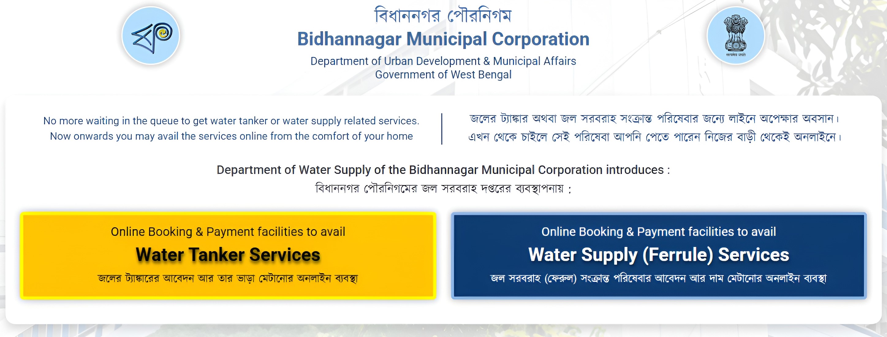


Board of Councillors
List of Present Board of Councillors
| Ward No | Photo | Name | Designation | Address | Mobile No. |
| Borough-1 | |||||
| 1 |  |
PINAKI NANDI | Councillor | SILVER- 802 AS - 185 SIDDHA PINES, NARAYANPUR, BIDHAN NAGAR MUNICIPAL CORPORATION, NORTH 24 PARGANAS, 700136 | 9831204944 |
| 2 |  |
RAHIMA BIBI (MONDAL) | MMIC | PASCHIM BERABERI NARAYANPUR, NORTH 24 PARGANAS, KOLKATA- 700136 | 9830843092 |
| 3 |  |
ARATRIKA BHATTACHARJEE | MMIC | LALKUTHI PARTHA NAGARI,NETAJI SANGHA CLUB,BMC KOLKATA-700136 | 9831988733 |
| 4 |  |
SHAHANOWAJ ALI MONDAL | Borough Chairman, BR-I | PACHIM BERABERI RAJARHAT- GOPALPUR, AIR PORT | 9051606204 |
| 5 |  |
NANDINI BANERJEE | Councillor | EA-21/2,DESBANDHU NAGAR, BAGUATI, BIDHAN NAGAR MUNICIPAL CORPORATION, KOLKATA - 700059 | 9830897289 |
| 6 | 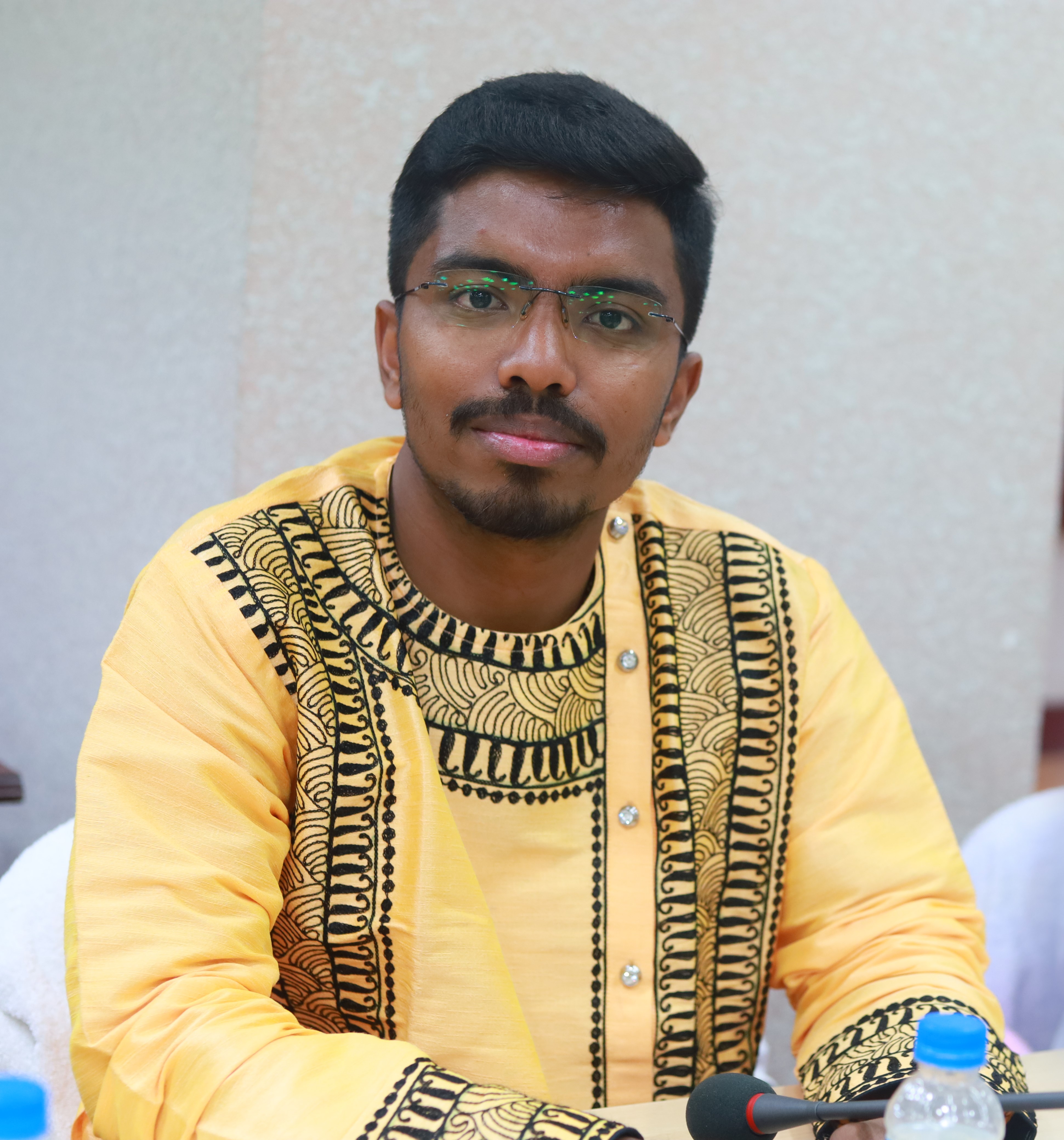 |
SAMRAT BARUA | Councillor | 2B, M.S. APARTMENT, MONDAL GANTHI, AIRPORT, KAIKHALI, BAGUIATI, NORTH 24 PARGANAS, KOLKATA-700052 | 8240573537 |
| 7 |  |
DEBRAJ CHAKRABORTY | MMIC | LICHU BAGAN (ANSHA), RAJARHAT, NORTH 24 PARGANAS, 700059 | 9830383345 |
| Borough-2 | |||||
| 8 |  |
SUPARNA GHOSH (PAUL) | Councillor | C/A/6/17, GOPALKUNJA, DESHBANDHUNAGAR, BAGUIATI, NORTH 24 PARGANAS, 700059 | 9831123435 |
| 9 |  |
SAMARESH CHAKRABORTY | Councillor | BF-7/64, DESHBANDHU NAGAR (NORTH), BAGUIATI, 700059 | 9830421535 |
| 10 |  |
PRANAY KUMAR RAY | Borough Chairman, BR-II | AB-4/8, DESHBANDHU NAGAR, BAGUIATI, NORTH 24 PARGANAS-700059 | 9433759719 |
| 11 |  |
ANITA BISWAS | Councillor | RAJARHAT GOPALPUR, HATIARA, NORTH 24 PARGANAS, PIN-700157 | 9836618721 |
| 12 | 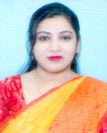 |
MOMOTA MONDAL | Councillor | ATGHARA, MAJHERPARA,P.O- GOPALPUR, P.S- BAGUIATI, KOLKATA-136 | 9830204029 |
| 13 | 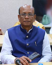 |
MD. SIRAJUL HAQUE | Councillor | METHOPARA, RAJARHAT, GOPALPUR, PIN-700157 | 9874353789 |
| Borough-3 |
|||||
| 14 | 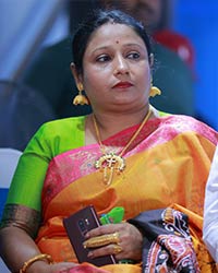 |
GITA SARDAR | Councillor | SARDAR PARA, PANDIT BATTALA HATIARA, WB, PIN-700157 | 9830007103 |
| 15 | 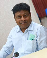 |
SUJIT MONDAL | MMIC | 6,MONDAL PARA,RAJARHAT GOPALPUR, BAGUIATI,KOLKATA-59 | 9830022397 |
| 16 |  |
JAYASHRI BAGUI | Councillor | H/H- 11, BHAIRAB BAGUI LANE , BAGUI PARA, ASHWININAGAR, BAGUIATI, KOL-700159 | 9007198170 |
| 17 | 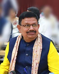 |
ASHUTOSH NANDI | Councillor | AF-29, RABINDRA PALLY, PRAFULLA KANAN, BAGUIATI, KOLKATA-102 | 9874667739 |
| 18 | 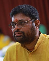 |
INDRANATH BAGUI | Councillor | DD-50, EAST NARAYAN TALA, EAST BAGUIATI ,P.O- ASWININAGAR, KOLKATA- 700159 | 9830702406 |
| 19 |  |
PIYALI SARKAR | Borough Chairperson, Br-III | J/J-8, DIGANTIKA, ASWININAGAR,P.S- BAGUIATI, KOLKATA-700159 | 9836606896 |
| Borough-4 | |||||
| 20 | 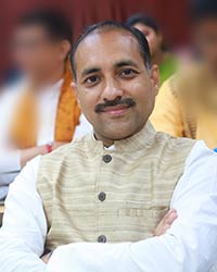 |
PROSENJIT NAG | Councillor | UJJAINI APARTMENT, SANTA ABASAN, P.S- ECO PARK, KOLKATA-700157 | 9007038952 |
| 21 |  |
MANORANJAN GHOSH | Councillor | ADARSHA PALLY, P.O- GOURANGANAGAR, P.S- NEW TOWN, KOLKATA-700162 | 9874995433 |
| 22 | 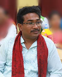 |
ATINDRA PRASAD SANA | Councillor | 9 NO. GOVT. COLONY, GOURANGANAGAR, NEW TOWN, NORTH 24 PARGANAS, KOLKATA- 700159 | 6291363175 |
| 23 | 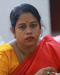 |
JHUNKU MONDAL | Councillor | BC- 36/37, PRAFULLA KANAN (PURBA), RAJARHAT GOPALPUR, BAGUIATI, KOLKATA- 700101 | 8420562207 |
| 24 | 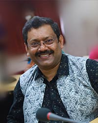 |
MANISH MUKHERJEE | Borough Chairman, Br-IV | AC-287/288,AKASH GANGA APARTMENT, KRISHNAPUR, RABINDRAPALLY, P.O-PRAFULLAKANAN, KOLKATA-700101 | 9830211213 |
| 25 |  |
PURNIMA NASKAR | Councillor | BI-15,KRISHNAPUR, PS-BAGUIATI,NORTH 24 PARGANAS, KOLKATA-700102 | 9163092508 |
| 26 |  |
SUSOBHAN MONDAL (MICHAEL) | Councillor | KRISHNAPUR, RAJBANSHI PARA,PO-KRISHNAPUR, PS-BAGUIATI, KOLKATA-700102 | 9831546219 |
| 27 | 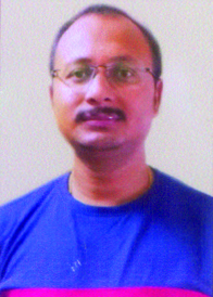 |
BINU MONDAL | Councillor | THAKDARI,PRAMANIK PARA, KRISHNAPUR, PS-NEWTOWN, KOLKATA-700102 | 9038339818 |
| 28 | 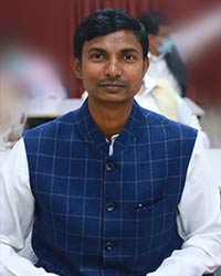 |
PRABIR SARDAR | Councillor | B-7, CHHAYANABHI, BIDHANNAGAR, PS-BIDHANNAGAR(S), NORTH 24 PARGANAS, KOLKATA-700105 | 9051258440 |
| Borough-5 | |||||
| 29 | 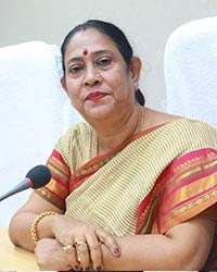 |
KRISHNA CHAKRABORTY | Mayor | CJ-90, SECTOR-II, SALTLAKE CITY, KOLKATA-700091 | 9830200271 |
| 30 | 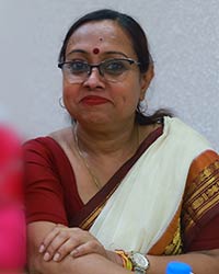 |
ANITA MONDAL | Deputy Mayor | AH - 229, SECTOR - II, SALT LAKE CITY, KOLKATA - 700091 | 9836670741 |
| 31 | 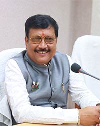 |
SABYA SACHI DUTTA | Chairman | DL-239, SALT LAKE, SECTOR - II, PIN-700091 | 9830055833 |
| 32 |  |
KAKALI SAHA | Councillor | DL-70,SALT LAKE,KOLKATA-700091 | 9830474263 |
| 33 |  |
BANIBRATA BANERJEE | MMIC | FD-6/1, BLOCK-FD, SALT LAKE CITY, SECTOR-III,BIDHANNAGAR,P.S - SOUTH BIDHANNAGAR,NORTH 24 PARGANAS-700106 | 9331377770 |
| 34 |  |
RANJAN PODDER | Borough Chairman, Br-V | D/8/4,SALT LAKE,KARUNAMOYEE HOUSING ESTATE,BLOCK-ED,NORTH 24 PARGANAS,KOLKATA-700091 | 9830687431 |
| Borough-6 | |||||
| 35 |  |
JAYDEV NASKAR | Councillor | NP-375,PURBAPARA, NAYAPATTY ELECTRONIC COMPLEX,NORTH 24 PARGANAS,KOLKATA-700102 |
9831119797 |
| 36 |  |
CHAMELI NASKAR MONDAL | Councillor | MB-158,MOHISHBATHAN,ABAD PARA,KOLKATA-700102 | 9836751825 |
| 37 |  |
MINU DAS (CHAKRABORTY) | Borough Chairperson, Br-VI | J/8,CLUSTER-IV,SALTLAKE,KOL-700097 | 8240102116/ 9230096226 |
| 38 |  |
ALO DUTTA | Councillor | 15,DUTTABAD ROAD,BIDHANNAGAR,KOL-700064 | 9088882024 |
| 39 |  |
RAJESH CHIRIMAR | MMIC | GC-29,BIDHANNAGAR,KOLKATA-700106 | 9831005660 |
| 40 |  |
TULSI SINHAROY | MMIC | BJ-162,SEC-II,SALT LAKE, KOL-91 | 9830171383 |
| 41 | 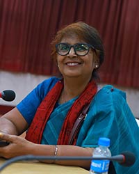 |
RATNA BHAUMIK | Councillor | AC-66,SEC-I,SALT LAKE,KOL-64 | 9831441352 |
!--
|
Smt. KRISHNA CHAKRABORTY |
- Hon'ble Mayor |
|
Shri. TAPASH CHATTERJEE |
- Hon'ble Deputy Mayor |
|
Smt. ANITA MONDAL |
- Hon'ble Chairperson |
Details of Members of Mayor-in-Council of Bidhannagar Municipal Corporation
|
Sl. No. |
Name |
Ward from which elected |
Department |
|
1 |
Sri BIRENDRA NATH BISWAS |
22 |
Water Supply |
|
2 |
Sri PRANAY KR. ROY |
10 |
Health |
|
3 |
Sri RAJESH CHIRIMAR |
39 |
Mass Education |
|
4 |
Smt. ROHIMA BIBI (MONDAL) |
2 |
Environment & Social Welfare Services |
|
5 |
Sri SUDHIR KR. SAHA |
32 |
Lighting & Park |
|
6 |
Sri DEBASISH JANA |
34 |
Solid Waste Management |
|
7 |
Sri DEBRAJ CHAKRABORTY |
7 |
Youth & Sports |
Details of Borough Chairman of Bidhannagar Municipal Corporation
|
Sl. No. |
Name |
Borough No |
Ward Nos. |
|
1 |
Sri SHAHANAOWAJ ALI MONDAL (DUMPY) |
I |
1-7 |
|
2 |
Sri MANISH MUKHERJEE |
II |
8-13 |
|
3 |
Sri SUJIT MONDAL |
III |
14-19 |
|
4 |
Sri BANIBRATA BANERJEE |
IV |
20-28 |
|
5 |
Smt. NEELANJANA MANNA |
V |
29-34 |
|
6 |
Smt MINU DAS CHAKRABORTY |
VI |
35-41 |
Board of Councilors, Bidhannagar Municipal Corporation
|
Ward No. |
Name of Councilor |
Home Address of Councilor |
|
1 |
SUSMITA DAS |
CHOTO GANTI PO GANTI VIA GANAGANAGAR PS. AIRPORTKOL-132 |
|
2 |
RAHIMA BIBI(MONDAL) |
NARAYANPUR WEST BERABERI, P.O. R GOPALPUR, PS. AIRPORT, KOL- 136 |
|
3 |
TAPASH CHATTERJEE |
LALKUTHI PARTHA NAGARI, P.O- R-GOPALPUR, P.S- AIRPORT, KOL-136, NORHT 24 PGS |
|
4 |
SHAHANOWAJ ALI MONDAL |
NARAYANPUR WEST BERABERI, PO. RAJARHAT-GOPALPUR, PS. AIRPORT. DIST. N 24 PGS., KOL- 136 |
|
5 |
SWATI BANERJEE |
AE- 340, SECTOR-I, SALT LAKE KOL-64 |
|
6 |
SUBHASH BOSE |
AD-1/1A, RAJARHAT RD. SUBARNAREKHA APARTMENT FLAT-DB4, JYANGRA CHOWMATHA, KOL59 |
|
7 |
DEBRAJ CHAKRABORTY |
AH/ 7 RAJARHAT ROAD , KHELAR MATH, GOBINDAN NIWAS, KOL-59 |
|
8 |
RITA SAHA |
BC-3/5, RAJARHAT ROAD, TALTALA JYANGRA, PS- BAGUIATI, KOLKATA- 700059 |
|
9 |
MANISH MUKHERJEE |
AC- 287/288, AKASH GANGA APARTMENT KRISHNAPUR, RABINDRAPALLY, PO- PRAFULLAKANAN, KOL- 101 |
|
10 |
PRANAY KUMAR RAY |
AB-4/8, DESHBANDHU NAGAR, P.O. DESHBANDHU NAGAR,BAGUIATI, KOL- 59 |
|
11 |
SONALI SAHA |
DD-12/12, SAHAPARA P.O. DESHBANDHU NAGAR, PS-BAGUIATI, KOLKATA- 700059 |
|
12 |
AZIZUL HOSSAIN MONDAL (KALO) |
ATGHARA, MAJHERPARA,P.O. - RAJARHAT GOPALPUR, KOL-136 |
|
13 |
MD. MOHASIN AHMED |
HATIARA (MAJHERPARA), P.O. - HATIARA,P.S. - NEW TOWN, KOLKATA - 700 157 |
|
14 |
GITA SARDAR |
HATIARA, SARDAR PARA, P.O. HATIARA, P.S. NEWTOWN, KOLKATA-700 157 |
|
15 |
SUJIT MONDAL |
DD- 6, JYANGRA MONDAL PARA, P.O. - JYANGRA, PS- BAGUIATI, KOLKATA- 700 059 |
|
16 |
SANDIP BAGUI |
H/H- 11, BAGUIPARA, PO- ASWININAGAR, PS- BAGUIATI, KOLKATA-700 059 |
|
17 |
SHAMPA CHAKRABORTY |
AB-51,PRAFULLA KANAN (WEST), KESTOPUR, P.O. PRAFULLAKANAN, KOLKATA-700 101 |
|
18 |
BASOBI DUTTA |
K/C-6 ASWININAGAR, BAGUIATI, PO- ASWININAGAR, KOLKATA-700 159 |
|
19 |
ANITA BISWAS |
BARABAGAN, PO. HATIARA, PS- NEW TOWN, KOLKATA-700 157 |
|
20 |
SHIBNATH BHANDARI |
ADARSHAPALLY, NABANIKETAN, PO-ASWININAGAR, KOLKATA-700 059 |
|
21 |
CHAMELI NASKAR MONDAL |
MAHISBATHAN, P.O. KRISHNAPUR, P.S. SALT LAKE ELECTRONICS COMPLEX, KOLKATA-700 102 |
|
22 |
BIRENDRA NATH BISWAS |
1 NO. NEW COLONY, P.O.-ASWININAGAR, P.S.-BAGUIATI, KOLKATA-700 159 |
|
23 |
ASHA NANDI |
AF-291, TALBAGAN, KRISHNAPUR, RABINDRA PALLY, P.O.- PRAFULLAKANAN, P.S.- BAGUIATI, KOLKATA-700101 |
|
24 |
ANUPAM MANDAL |
PC-41, ARJUNPUR, SHIBTALA, P.O. ARJUNPUR, P.S. BAGUIATI, KOLKATA- 700059 |
|
25 |
BIKASH NASKAR |
B-1,KRISHNAPUR, MAJHER PARA, KOL-102 |
|
26 |
SHILA MONDAL |
KRISHNAPUR, RAJBANSHI PARA, KOL-102 |
|
27 |
PROSENJIT SARDAR |
NEYE PARA, THAKDARI, KRISHNAPUR, KOL-102 |
|
28 |
BANIBRATA BANERJEE |
FD-6/1, SALT LAKE CITY, SEC-III, KOL-106 |
|
29 |
KRISHNA CHAKRABORTY |
CJ-90, SALT LAKE, KOL-91 |
|
30 |
ANITA MONDAL |
AH-229, SALT LAKE CITY, KOL-91 |
|
31 |
SABYASACHI DUTTA |
DL-239, SEC-II, Salt Lake City, Kol-700 091 |
|
32 |
SUDHIR KUMAR SAHA |
CE 148, SEC-I, SALTLAKE CITY, KOL-64 |
|
33 |
NEELANJANA MANNA |
A/2,FD-451,SALTLAKE CITY, KOL-106 |
|
34 |
DEVASISH JANA |
AE-788, SEC-I, SALTLAKE , KOL-64 |
|
35 |
JAYDEV NASKAR |
NP-383, NAYAPATTY (OLD- 375), KOL-102 |
|
36 |
PRABIR SARDAR |
B-7, CHHAYNABHI, NOWBHANGA, BIDHANNAGAR (W), KOL-105 |
|
37 |
MINU DAS (CHAKRABORTY) |
J/8, CLUSTER-IV, PURBACHAL, GA- BLOCK, SECTOR-III, SALTLAKE, KOL-97 |
|
38 |
NIRMAL DUTTA |
15 DUTTABAD, SALTLAKE, KOL-64 |
|
39 |
RAJESH CHIRIMAR |
GC-29, BIDHANNAGAR, SALTLAKE, BIDHANNAGR SOUTH KOLKATA, NORTH 24 PGS-106 |
|
40 |
TULSI SINHA ROY |
BJ-162, SECTOR-II, SALTLAKE, KOL-91 |
|
41 |
ANINDYA CHATTERJEE |
BA-136, SECTOR-1, SALTLAKE, KOL-64 |
-->
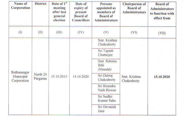
Previous Board of Councillors, Bidhannagar Municipal Corporation (Tenure : 2015-2020)